Sample Template For PTE Describe Image Maps – Practice Test 3
PTE Describe Image Maps – You have 25 seconds to recognize the image. Describe the image including important keywords in your own words in about 40 seconds. Here is – PTE Describe Image Maps Sample Questions and Answers.
In case you find it difficult to explain, how to describe image in PTE.
Don’t forget to write your own answer in the comment box.
PTE Describe Image Maps
# PTE Describe Image Maps – Question no. 1

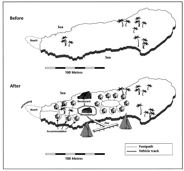
The given picture depicts a small island before and after it was developed for tourism. The island is 100 meters long, has palm trees, surrounded by the sea and has a beach at one of its ends, however, turning to the second picture, we can see that most of the empty space has been occupied to construct new facilities. Facilities like accommodations, restaurant, swimming facilities etc have been constructed without affecting the natural resources that much. There is also a short road linking the pier with the reception and restaurant, and every other area is connected via a footpath. To conclude, tourism facilities made greater development on this island, but it became congested.
# PTE Describe Image Maps – Question no. 2

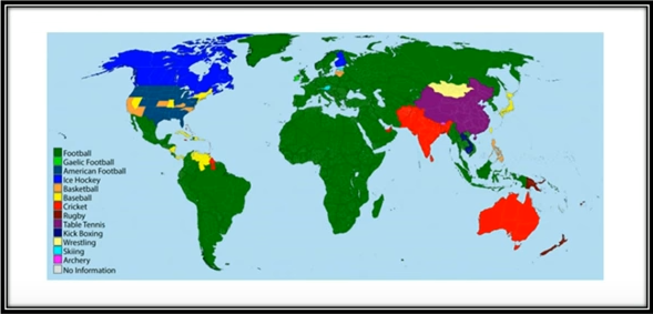
The given map shows number the players participated in different sports on different continents. The highest participants participated in football in the continent South America, Africa and Asia. In North America, the number of players participated in Ice hockey and American football whereas, in Australia and India, Cricket was the famous sport. Moreover, Rugby, table tennis, kickboxing and Archery was the least famous sport among all continents.
To stay updated for more PTE Describe Image Maps Questions along with Answers, like us on Facebook.